recommended route
Winter hiking
· South of South Tyrol
Open
recommended route
Winter hiking
· South of South Tyrol
Open
Anterivo/Altrei-Fraulalm winter
Südtirols Süden
-
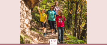
 Hiking in winter to the Malga FraulPhoto: TV Trudner Horn / Thomas Monsorno, Südtirols Süden
We follow the sign "Guggal" (N. 8) which is in front of the hotel "Zum Rössl". We walk down to the stream "Guggal" through wonderful meadows and then up to the component locality Guggal. From here we follow the branding N. 8 through grasslands with larches on it until we reach the alpine cabin "Fraulalm" (unmanaged).
The closely located "Schönblick" is for sure worth a quick side-trip. Back to the alpine cabin we follow the sign N. 7 "Sportplatz" and reach the access road to Altrei/Anterivo. After about 200m we get to the sports area and to the bar "Ebnerrast" which is the only possibility of fare. Now we follow the sign "Altrei".
Author’s recommendation
Walk through the hamlet of Guggal.
Südtirols Süden
Derived from the technical difficulty and the stamina requirements.
Track types
Show elevation profileSafety information
Stay on the marked trails and check the latest weather forecast before the hike.Roadbook
The hike starts in front of Hotel “Zum Rössl” in Altrei and follows the signs towards “Guggal” (trail no. 8). The route descends across meadow slopes to the Guggal stream and then climbs up to the hamlet of Guggal. From there, trail no. 13 leads through larch meadows to the Fraulalm mountain hut.
Parish Church in Altrei/Anterivo
Drinking water fountain Altrei Pichl
Public transport
Bus line 120 operates from the bus station at Bolzano Railway Station to the bus station in Neumarkt. From there, bus line 144 provides a direct connection to Altrei. The final stop, “Altrei Centro”, is located in the village centre.
Get Timetable to destination
Directions
From the South Tyrolean Lowlands, the road leads via Truden directly to Altrei.
Parking
At the public parking area next to the “Altrei, Centre” bus stop.
Coordinates
Equipment
Sturdy footwear and warm, weather-appropriate clothing.Derived from the technical difficulty and the stamina requirements.
Statistics


 Find accommodation