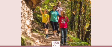
recommended route
Hiking trail
· South of South Tyrol
Open
recommended route
Hiking trail
· South of South Tyrol
Open
Radein/Redagno - Jochgrimm/Passo Oclini
Südtirols Süden
-
 RadeinPhoto: TG Südtirols Süden, Südtirols Süden
Hike from Redagno to Jochgrimm
The hike from Redagno to Jochgrimm takes you through the beautiful mountain landscape surrounding Redagno, offering a pleasant combination of forest paths, alpine meadows and impressive views of the surrounding mountains. The starting point of the hike is the GEOMuseum in Redagno. From here, the trail gradually climbs towards Jochgrimm, a popular destination for hikers and an ideal starting point for numerous other mountain tours.
The classic route first leads from Redagno towards the Nigglhof farm. Following trails no. 7A and 7, the route continues towards the Isi-Hütte and the Kalditscher Alm. From here, the trail continues uphill to Jochgrimm at an altitude of 1,989 m. The route runs mainly through the forest and along quiet paths before gradually opening up to reveal beautiful views of the surrounding peaks and alpine pastures.
There are also two attractive alternative routes. The Gurndin Alm variant starts at the Nigglhof farm and follows trails no. 7A and 7 until reaching the blue trail. Following this trail, mostly through the forest, you reach the picturesque Gurndin Alm at 1,952 m. From there, forest road no. 12A continues uphill to Jochgrimm.
Another option is the Zirmersteig variant. Starting at the GEOMuseum in Redagno, follow trail no. 12/W towards the Laner meadows. The route continues via the Zirmersteig and the new trail no. 12A to the Gurndin Alm. From there, follow forest road no. 12A to Jochgrimm.
With a walking time of approximately two hours and an elevation gain of around 435 metres, the hike is classified as easy and is particularly suitable for leisure hikers and families with some hiking experience. The steady ascent and generally easy-to-walk paths make this route a pleasant way to discover the natural landscape between Redagno and Jochgrimm.
Once you reach Jochgrimm at 1,989 m, you are rewarded with an expansive alpine landscape. The mountain pass lies between the Weißhorn and Schwarzhorn and impresses with its open high-mountain scenery, alpine meadows and magnificent panoramic views of the surrounding peaks. The combination of peaceful forest paths, lush alpine pastures and the impressive mountain backdrop makes this hike a particularly rewarding experience.
Author’s recommendation
Südtirols Süden
Derived from the technical difficulty and the stamina requirements.
Track types
Show elevation profileSafety information
The hike takes place in alpine terrain. Pay attention to changing weather conditions, ensure sure footing and use suitable equipment. Extra caution is required in snow or icy conditions.Roadbook
From Radein to Nigglhof - ascent on nr. 7A and 7 to the Isi hut/Kalditscher Alm-on trail nr. 7 to Jochgrimm, 1989m.
Variant Gurndinalm: Ascent from Nigglhof on trail nr. 7A and 7 until meeting with the Blauweg - follow this mostly along the forest to the Gurndinalm, 1952m - on FOrstweg nr. 12A to the Jochgrimm, 1989m.
Variant Zirmersteig: From Radein, Geomuseum, on trail no. 12/W to the Laner Wiesen - via the Zirmersteig and new trail no. 12A to the Gurndinalm, 1952m - along forest trail no. 12A to the Jochgrimm, 1989m.
From Radein to Jochgrimm. Starting point: GEOMuseum
Level of difficulty=easy
Walking time: approx. 2 hours
Difference in altitude: 435 m
Geomuseum Radein
Geomuseum Radein
St. Wolfgang Church Radein / Redagno
St. Wolfgang Church
Library Radein/Radegno
Library Radein/Radegno
Isi hut
Public transport
Getting to the starting point of the tour or point of interest by public transport is easy and convenient.Get Timetable to destination
Directions
Jochgrimm is easily accessible from the South Tyrolean lowlands and the surrounding villages.Parking
Parking spaces are available at the car park in Jochgrimm.Coordinates
Equipment
Sturdy hiking boots, weather-appropriate clothing, warm layers for higher elevations, enough water, sun protection and hiking poles if needed are recommended.Derived from the technical difficulty and the stamina requirements.
Statistics


 Find accommodation