Find accommodation
Logo Südtirol
skip to content
Hiking trail Hiking trail  · South of South Tyrol Open

The ropewayhike

Responsible for this content
Südtirols Süden
  • Forno della calce sul sentiero della funivia
    Forno della calce sul sentiero della funivia
    Photo: Südtirols Süden
Map / The ropewayhike

Selected alternatives for you
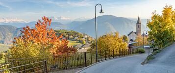
    Easy themed hike in Gfrill following a former cableway, featuring historic sites, forest trails and beautiful views over the Salorno Gorge.
    Open
    Easy
    Distance 2.8 km
    0:59 h
    3 m
    435 m
    1,340 m
    905 m

    The Cableway Trail in Cauria, above Salorno, combines a pleasant walk through nature with fascinating insights into the region's history. The trail focuses on a former cableway once used to transport timber and other materials, which played an important role in this mountain area.

    The hike starts in the small mountain village of Cauria, near St. Margaret's Church. From here, the trail leads through the surrounding forests towards Unterstein. Along the former cableway route, historical remains offer a glimpse into how the installation was once used.

    The route continues through peaceful woodland to Pinterhof farm. Along the way, the natural surroundings and views of the nearby mountains invite you to discover the landscape around Cauria.

    A lovely walk for anyone who enjoys combining nature with a little local history.

    Author’s recommendation

    Spring and autumn are the best seasons for this hike, offering pleasant temperatures, colourful forests and excellent visibility.
    Responsible for this content
    Südtirols Süden 
    Difficulty
    Easy
    Overall difficulty
    Easy

    Derived from the technical difficulty and the stamina requirements.

    Experience
    Landscape
    Highest point
    1,340 m
    Lowest point
    905 m
    Best time of year
    Jan
    Feb
    Mar
    Apr
    May
    Jun
    Jul
    Aug
    Sep
    Oct
    Nov
    Dec

    Track types

    Show elevation profile

    Rest stops

    Fichtenhof

    Safety information

    The trail is well marked and technically easy. Some sections may become slippery after rain. Stay on the marked paths and take care around the historical structures.

    Roadbook

    The hike starts in the center of the village Gfrill/Cauria at the hiking path number 8, direction "Unterstein", past the limekiln, remembering the times of hardworking lime-burners. After 10 minutes, the walk turns right into a mule track, which leads through "Unterstein" on the forest road to the wolf-pit, which is an evidence of the strong spread of the wolf packs, which have been caught until the 19th century.

    The walk continues through the forest, at the end you arrive to the old ropeway station, enjoying an incredible panoramic view. The return path is the same.

    Rest stop
    Tip
    Nearby
    Top Partner
    Waypoint
    Start point
    End point
    Low point
    High point
    Forecast
    Today {low} to {high} and {precipitation} of {precipitation_type}
    show {x} more
    Photo
    Video
    Gfrill/Cauria Information Center
    Gfrill/Cauria Information Center
    Parish church S. Margherita
    Parish church S. Margherita
    Fichtenhof
    E-bike charging station in Gfrill/Cauria

    Public transport

    Take the train to Salorno railway station and continue by local bus to Gfrill. Please check the current timetable before travelling.

    Get Timetable to destination

    to
    The ropewayhike

    Directions

    Freeway A22, exit Egna/Ora, direction Salorno and continue to Cauria

    Parking

    Free parking is available in the centre of Gfrill close to the trailhead.

    Coordinates

    DD
    46.272194, 11.284375
    DMS
    46°16'19.9"N 11°17'03.8"E
    UTM
    32T 676013 5126827
    w3w 
    ///expect.shard.expectations
    Get there by train, car, bike, or on foot!

    Equipment

    Hiking boots
    Weather-appropriate clothing
    Drinking water
    Sun protection
    Lightweight rain jacket
    Smartphone or hiking map

    Similar routes nearby

    • Trail d | Gfrill - Altrei
    • Gfrill/Caria - Trudner Horn/Monte Corno
    • Cauria trail
    • Trail b1 | Cauria – Aldino
    • Trail c | Gfrill - Montan
    • Hiking tour: Gschnon/Casignano - Königswiese
    • From Gschnon/Casignano to Trudner Horn
     These suggestions were generated by our system
    Status
    Open
    Difficulty
    Easy
    Overall difficulty
    Easy

    Derived from the technical difficulty and the stamina requirements.

    Distance
    2.8 km
    Duration
    0:59 h
    Ascent
    3 m
    Descent
    435 m
    Highest point
    1,340 m
    Lowest point
    905 m
    Family-friendly Linear route

    Statistics

    • Content
    • Show images Hide images
    Features
    Maps and trails
    Nothing selected - click and drag in the elevation profile to zoom
    Distance
    Duration
    Ascent
    Descent
    Elevation profile
    ✖
    jenesien-herbst-4-tv-jenesien-michael-guggenberg
    Jenesien newsletter

    Jenesien, always close even from afar – with our newsletter!

    Sign up now and get the latest information about our gentle holiday region delivered straight to your home.

    We look forward to having you with us!


    Sign up now!