recommended route
Hiking trail
· South of South Tyrol
Open
recommended route
Hiking trail
· South of South Tyrol
Open
Around Trodena/Trodena
Responsible for this content
Südtirols Süden
Südtirols Süden
-
 church squarePhoto: Südtirols Süden
Selected alternatives for you
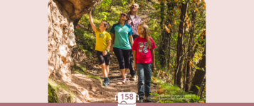
Easy circular walk through Truden featuring historic buildings, scenic viewpoints and insights into the nature and culture of Trudner Horn Nature Park.
Open
easy
Distance 1.8 km
0:31 h
76 m
76 m
1,182 m
1,106 m
Due to its isolated position, Trodena still retained many testimonies of what men have conceived, built and transformed here over the centuries. On the circular route of Trodena we will learn about the centuries-old urban culture. From the town square we move towards the upper part of the town, pass in front of a 700-year-old lime tree and walk along the paved road up to the entrance to the town. From there we follow trail marker 3 to a parking lot. From the panoramic road (3A) we come to a viewing platform, a sort of balcony. from which we can admire the "3 horns": Corno Nero,
Corno Bianco and Monte Corno. This is where the geological "line" of Trodena develops. The view over the roofs of Trodena testifies to the division of the farms that has taken place for generations. We then walk until we reach the Via Cislon. From here we follow trail no. 1 to return to the starting point of Trodena, which we will reach through the historic center.
Tip: take a walk in the village to discover the "The walls tell" project ... The brochure is available at the tourist office. Also discover the Monte Corno Visitor CenterAlso suitable as a family hike. Accessible with a stroller.
Author’s recommendation
Visit the Trudner Horn Nature Park Visitor Centre to learn more about the area's unique geology, wildlife and landscapes.
Responsible for this content
Südtirols Süden
Südtirols Süden
Difficulty
easy
Overall difficulty
easy
Derived from the technical difficulty and the stamina requirements.
Experience
Landscape
Highest point
1,182 m
Lowest point
1,106 m
Best time of year
Jan
Feb
Mar
Apr
May
Jun
Jul
Aug
Sep
Oct
Nov
Dec
Track types
Show elevation profileSafety information
The route follows well-maintained paths and is technically easy. Some sections may be slippery after rain. Take care on the short road sections.Roadbook
The walk starts in the centre of Truden. Follow the local signs through the historic village before continuing along quiet roads and walking paths beside meadows and woodland. Several viewpoints offer panoramic views of Trudner Horn, the Adige Valley and the surrounding mountains. The circular route eventually returns to the village centre.
Rest stop
Nearby
Top Partner
Waypoint
Start point
End point
Low point
High point
Forecast
Today {low} to {high} and {precipitation} of {precipitation_type}
show {x} more
Photo
Video
Parish Church San BiagioDrinking water fountain Truden i.N. Sägeweg
600 years old lime ain Truden i.N.
Charge E-Car Truden i.N.
Monte Corno Nature Park visitor centre
drinking water fountain Kajetan Pacher Str. Truden i.N.
Drinking water fountain Truden i.N. Dorfeingang
Limekiln in Truden i.N.
Public transport
Take the train to Neumarkt-Tramin, then continue by local bus to Truden.Get Timetable to destination
Around Trodena/Trodena
Directions
Take the A22 motorway to the Neumarkt-Auer exit, continue along the SS48 to Kaltenbrunn and follow the road to Truden.Parking
Free parking is available in the village centre and near the parish church.Coordinates
DD
46.321582, 11.349301
DMS
46°19'17.7"N 11°20'57.5"E
UTM
32T 680852 5132460
w3w
///flapper.flattens.straddle
Get there by train, car, bike, or on foot!
Equipment
Sturdy walking shoesWeather-appropriate clothing
Drinking water
Sun protection
Status
Open
Difficulty
easy
Overall difficulty
easy
Derived from the technical difficulty and the stamina requirements.
Distance
1.8 km
Duration
0:31 h
Ascent
76 m
Descent
76 m
Highest point
1,182 m
Lowest point
1,106 m
Statistics
Maps and trails
Nothing selected - click and drag in the elevation profile to zoom
Distance
Duration
Ascent
Descent


 Find accommodation