
 Hiking trail
· South of South Tyrol
Open
Jochgrimm - Schwarzhorn
Südtirols Süden
-
 Corno nero - MadonnaPhoto: Südtirols Süden
The hike starts at the car park at Jochgrimm. From here, the trail initially follows the ski slope up to the upper ski lift station. You then continue along an increasingly steep and rocky mountain trail, climbing the northern ridge to the summit of Schwarzhorn/Corno Nero.
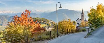
At the summit, you'll be rewarded with breathtaking 360-degree views. The panorama stretches from the Zillertal Alps across the Rosengarten/Catinaccio and Latemar mountains to the Pale di San Martino and the peaks of the Lagorai range. On clear days, you can also see the Ortler group, the Brenta Dolomites and the mountains surrounding Lake Garda.
The return route follows the southwestern ridge down towards Kugeljoch pass. From here, the trail leads through a light-filled Swiss stone pine forest back to the starting point at Jochgrimm. Sure-footedness and good physical fitness are required for the steeper sections.
Author’s recommendation
Südtirols Süden
Derived from the technical difficulty and the stamina requirements.
Track types
Show elevation profileRest stops
Hotel SchwarzhornRepair pillar for bicycles Car Park Jochgrimm/Oclini
Hotel Jochgrimm
Safety information
This hike requires sure-footedness and good physical fitness. Rocky sections can become slippery when wet, and mountain weather may change rapidly. Always check the forecast before setting out.Roadbook
The descent leads down the south side of the Schwarzhorn towards the Flaimvalley. Shortly before the Kugeljoch the path turns right, after which we follow path no. 14 back to the starting point.
Hotel Schwarzhorn
Jochgrimm
Repair pillar for bicycles Car Park Jochgrimm/Oclini
Hotel Jochgrimm
Schwarzhorn
Aussicht auf das Val di Fiemme
Il Palone
Public transport
Seasonal public bus services connect Jochgrimm with the surrounding valleys. Please check current timetables before your hike.Get Timetable to destination
Directions
Coming from the south:
Take the “Neumarkt/Auer” exit of the Brenner autobahn A22 and continue via Montan to the Fleims Valley / Val di Fiemme. Continue on towards Cavalese. Just before you get to Cavalese, take the turn-off to Varena and continue on towards the Lavazè Pass. From there, continue westwards over the Pass road to the Jochgrimm parking (ital. Passo Oclini) (driving time from the autobahn exit: approx. 45 minutes).
Coming from the north:
Take the “Bozen-Nord” autobahn exit from the A22 and follow the signposts directing you to the Eggen Valley (Eggental/Val d’Ega) and continue on towards the Lavazè Pass. From there, as described above, proceed westwards to the Jochgrimm (driving time from the autobahn exit: approx. 35 – 40 minutes).
When traveling by bus, we recommend coming via Bozen / Bolzano and the Eggen Valley.
Parking
Free parking is available directly at the Jochgrimm trailhead.Coordinates
Equipment
Sturdy mountain bootsWeather-appropriate clothing
Warm extra layer
Plenty of drinking water
Food
Sun and rain protection
Hiking map or GPS device
Hiking poles (optional)
Derived from the technical difficulty and the stamina requirements.
Statistics


 Find accommodation