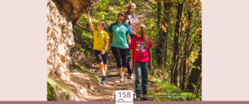
Hiking trail
· Bolzano and surroundings
Open
Round Trail Avigna/Afing - Dosso Nero/Schwarzegg
Responsible for this content
Jenesien
Jenesien
-
 Avigna/Afing with DossoNeroPhoto: Jenesien
Selected alternatives for you
Open
Difficult
Distance 10.9 km
3:56 h
590 m
587 m
1,466 m
876 m
Starting from the village center of Avigna, follow the indication of path no.27 „Putenkreuz“
towards maso „Rohrwieserhof“ and maso „Perkmannshof“. From there, follow
the indication of „Rundweg Schwarzegg“ and keep always to the right towards Avigna.
Responsible for this content
Jenesien
Jenesien
Difficulty
Difficult
Overall difficulty
Difficult
Derived from the technical difficulty and the stamina requirements.
Experience
Landscape
Highest point
1,466 m
Lowest point
876 m
Best time of year
Jan
Feb
Mar
Apr
May
Jun
Jul
Aug
Sep
Oct
Nov
Dec
Track types
Show elevation profileRest stops
Market/Café BuchicenterAlbergo Moar
Organic Farm Market Ausserbrunner
Rest stop
Nearby
Top Partner
Waypoint
Start point
End point
Low point
High point
Forecast
Today {low} to {high} and {precipitation} of {precipitation_type}
show {x} more
Photo
Video
Bus stop Afing Dorf/Avigna paeseTown centre Avigna
Market/Café Buchicenter
Schrott Alfred
Domanegg Manfred
Guggenbergerhof
Albergo Moar
Rokk Kälte & Klima des Roland Obkircher
Organic Farm Market Ausserbrunner
Public transport
Get Timetable to destination
Round Trail Avigna/Afing - Dosso Nero/Schwarzegg
Coordinates
DD
46.564458, 11.352225
DMS
46°33'52.0"N 11°21'08.0"E
UTM
32T 680274 5159453
w3w
///levity.amounts.awoke
Get there by train, car, bike, or on foot!
Status
Open
Difficulty
Difficult
Overall difficulty
Difficult
Derived from the technical difficulty and the stamina requirements.
Distance
10.9 km
Duration
3:56 h
Ascent
590 m
Descent
587 m
Highest point
1,466 m
Lowest point
876 m
Statistics
Maps and trails
Nothing selected - click and drag in the elevation profile to zoom
Distance
Duration
Ascent
Descent


 Find accommodation