Road biking
· South of South Tyrol
Open
Panoramatour Jochgrimm/Oclini - Lavazè
Responsible for this content
Südtirols Süden
Südtirols Süden
-
 OcliniPhoto: Südtirols Süden
Selected alternatives for you
Open
Moderate
Distance 42 km
2:37 h
1,353 m
1,354 m
1,994 m
969 m
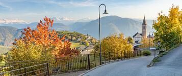
This varied road cycling tour starts in Truden in the Nature Park and leads over Passo Oclini and Passo Lavazè through the Fiemme Valley before returning to the starting point. Challenging climbs, scenic mountain roads and rewarding descents are complemented by breathtaking panoramic views, making this route an unforgettable experience for experienced road cyclists.
Responsible for this content
Südtirols Süden
Südtirols Süden
Difficulty
Moderate
Overall difficulty
Moderate
Derived from the technical difficulty and the stamina requirements.
Experience
Landscape
Highest point
1,994 m
Lowest point
969 m
Best time of year
Jan
Feb
Mar
Apr
May
Jun
Jul
Aug
Sep
Oct
Nov
Dec
Track types
Show elevation profileRest stop
Nearby
Top Partner
Waypoint
Start point
End point
Low point
High point
Forecast
Today {low} to {high} and {precipitation} of {precipitation_type}
show {x} more
Photo
Video
Charge E-Car Truden i.N.600 years old lime ain Truden i.N.
Monte Corno Nature Park visitor centre
Charge E-Car in Truden i.N.
Isi hut
Malga Gurndin Alm
Jochgrimm
Dolomiti Orientali - Corno Bianco
Rete di Riserve Val di Fiemme destra Avisio
Malga Varena
Altopiano di Lavazé
Lavazèjoch
Museo Casa Natale Antonio Longo
Biblioteca Muratori
Palace of Magnifica Comunità Fiemme
Contemporary Art Museum Cavalese
Chiesa di S. Vigilio e convento dei Frati Francescani
Biotopo di Brozin
Brozin Biotope
Passo di San Lugano
Public transport
Get Timetable to destination
Panoramatour Jochgrimm/Oclini - Lavazè
Coordinates
DD
46.322800, 11.350365
DMS
46°19'22.1"N 11°21'01.3"E
UTM
32T 680930 5132598
w3w
///burns.critique.treating
Get there by train, car, bike, or on foot!
Status
Open
Difficulty
Moderate
Overall difficulty
Moderate
Derived from the technical difficulty and the stamina requirements.
Distance
42 km
Duration
2:37 h
Ascent
1,353 m
Descent
1,354 m
Highest point
1,994 m
Lowest point
969 m
Statistics
Maps and trails
Nothing selected - click and drag in the elevation profile to zoom
Distance
Duration
Ascent
Descent


 Find accommodation