recommended route
Hiking trail
· South of South Tyrol
Open
recommended route
Hiking trail
· South of South Tyrol
Open
From Truden/Trodena to the Krabes Alm/Malghette
Responsible for this content
Südtirols Süden
Südtirols Süden
-
 Langes Moos/Palude LOngaPhoto: Südtirols Süden
Selected alternatives for you
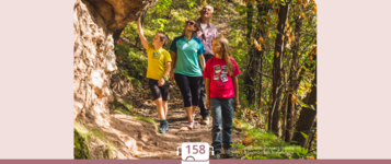
Scenic circular hike from Trodena through the forests of the Trudner Horn Nature Park to Krabes Alm.
Open
moderate
Distance 10.5 km
3:22 h
488 m
489 m
1,562 m
1,109 m
A varied circular hike from Trodena via Rungganò Farm, Peraschupf and Langes Moos to Krabes Alm/Malghette. Passing through forests, meadows and the diverse natural landscapes of the Trudner Horn Nature Park, the route leads back to Truden.
Responsible for this content
Südtirols Süden
Südtirols Süden
Difficulty
moderate
Overall difficulty
moderate
Derived from the technical difficulty and the stamina requirements.
Experience
Landscape
Highest point
1,562 m
Lowest point
1,109 m
Best time of year
Jan
Feb
Mar
Apr
May
Jun
Jul
Aug
Sep
Oct
Nov
Dec
Track types
Show elevation profileRoadbook
From the saddle at the northern end of Truden, the trail initially heads south along the Forchwaldegg to Rungganö Farm. From there, it continues across meadows and then follows trail no. 5 uphill through the forest to Peraschupf. The hike continues through varied woodland and natural scenery to Langes Moos. From there, follow trail no. 9 to Krabes Alm (1,540 m), a welcoming place to stop for refreshments during the summer months. For the return to Truden, follow trail no. 6. After a short ascent, the trail leads through the forest before descending, somewhat more steeply in places, to the Alte Säge. From there, continue back to the starting point in Truden.
Rest stop
Nearby
Top Partner
Waypoint
Start point
End point
Low point
High point
Forecast
Today {low} to {high} and {precipitation} of {precipitation_type}
show {x} more
Photo
Video
Charge E-Car Truden i.N.Monte Corno Nature Park visitor centre
drinking water fountain Kajetan Pacher Str. Truden i.N.
Charge E-Car in Truden i.N.
Drinking water fountain Truden i.N. Dorfeingang
Krabes Alm
Parish Church San Biagio Truden / Truden i.N.
Parish Church San Biagio
600 years old lime ain Truden i.N.
600 years old lime ain Truden i.N.
Public transport
Line 144: Neumarkt–Montan–Truden–AltreiGet Timetable to destination
From Truden/Trodena to the Krabes Alm/Malghette
Directions
By car:
From Auer/Ora or Neumarkt/Egna, drive via Montan/Montagna and Kaltenbrunn/Fontanefredde to Truden/Trodena. The starting point of the hike is located at the northern end of the village.
By public transport:
Trodena can be reached by bus line 144 (Egna–Montagna–Trodena–Anterivo).
Parking
Parking is available in the centre of Truden. From there, the starting point of the hike is just a few minutes’ walk away.Coordinates
DD
46.322076, 11.349378
DMS
46°19'19.5"N 11°20'57.8"E
UTM
32T 680857 5132515
w3w
///unwinding.bike.prances
Get there by train, car, bike, or on foot!
Status
Open
Difficulty
moderate
Overall difficulty
moderate
Derived from the technical difficulty and the stamina requirements.
Distance
10.5 km
Duration
3:22 h
Ascent
488 m
Descent
489 m
Highest point
1,562 m
Lowest point
1,109 m
Statistics
Maps and trails
Nothing selected - click and drag in the elevation profile to zoom
Distance
Duration
Ascent
Descent


 Find accommodation