Mountainbiking
· Bolzano and surroundings
Mountainbiking
· Bolzano and surroundings
Double gondola tour

Responsible for this content
Eppan an der Weinstraße
Eppan an der Weinstraße
-
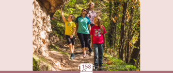
 Photo: Klaudia Zublasing, Eppan an der Weinstraße
Selected alternatives for you
Flow, city and mountains
difficult
Distance 49.1 km
6:30 h
2,569 m
2,569 m
1,637 m
261 m
A freeride or easy rider tour par excellence! Thanks to the two mountain lifts, this tour only involves about 600 meters of ascent, while about 2,500 meters of descent – partly flowing, partly technical – can be enjoyed. On the shady slope of the Kohlerer descent, the biker has a view of the provincial capital Bolzano, while the Rittner descent on the sunny side offers a unique Dolomite panorama. A tour for trail addicts!
If time and fitness allow, an extension of the tour to the Rittner Horn (2,200 m) is recommended. The summit with an impressive 360° panorama is one of the most beautiful viewpoints in South Tyrol. The ascent to the Rittner Horn can be shortened by the cable car.

Author
Klaudia Zublasing

Responsible for this content
Eppan an der Weinstraße
Eppan an der Weinstraße
Difficulty
difficult
Overall difficulty
difficult
Derived from the technical difficulty and the stamina requirements.
Experience
Landscape
Highest point
1,637 m
Lowest point
261 m
Best time of year
Jan
Feb
Mar
Apr
May
Jun
Jul
Aug
Sep
Oct
Nov
Dec
Track types
Show elevation profileRest stop
Nearby
Top Partner
Waypoint
Start point
End point
Low point
High point
Forecast
Today {low} to {high} and {precipitation} of {precipitation_type}
show {x} more
Photo
Video
Cable car KohlernKohlerer Cable Car
Parkplatz an der Kohlernseilbahn
Musikkapelle Zwölfmalgreien
Plattform Land
The Renon cable railway
Oswaldpromenade
S. Magdalene in Prazöll
S. Maddalena hill
S. Maddalena hill
The Renon Railway
St. George and St. Jacob Church
Railway Ritten
Railway Ritten
Gottfried Stabler
Hexenbödele
St. Andreas Church
Wasserer Farm
The Cornèdo Burg Karneid Castle
municip
Public transport
Get Timetable to destination
Double gondola tour
Coordinates
DD
46.491057, 11.368491
DMS
46°29'27.8"N 11°22'06.6"E
UTM
32T 681766 5151335
w3w
///parade.friday.halt
Get there by train, car, bike, or on foot!
Difficulty
difficult
Overall difficulty
difficult
Derived from the technical difficulty and the stamina requirements.
Distance
49.1 km
Duration
6:30 h
Ascent
2,569 m
Descent
2,569 m
Highest point
1,637 m
Lowest point
261 m
Statistics
Maps and trails
Nothing selected - click and drag in the elevation profile to zoom
Distance
Duration
Ascent
Descent


 Find accommodation